Not sure where the best bike routes are in your neighborhood? Want to find the closest secure bike lockers? These maps will help you plan your next bicycle trip.
- Bike Mapper
- Contra Costa Bike Locker Maps
- East Bay Regional Park District Bike Maps
- Other Regional & Bay Area Bike Maps
511CC’s Bike Mapper

Bike Mapper is a valuable bike trip mapping service. The simple interface generates nine route options for you to pick from when you select from three hill tolerances and three levels of bike infrastructure: adherence to mostly bike paths, bike lanes, or the most direct route. The Contra Costa Bike Mapper covers the majority of the 9-county Bay Area.
Contra Costa Bike Locker Maps
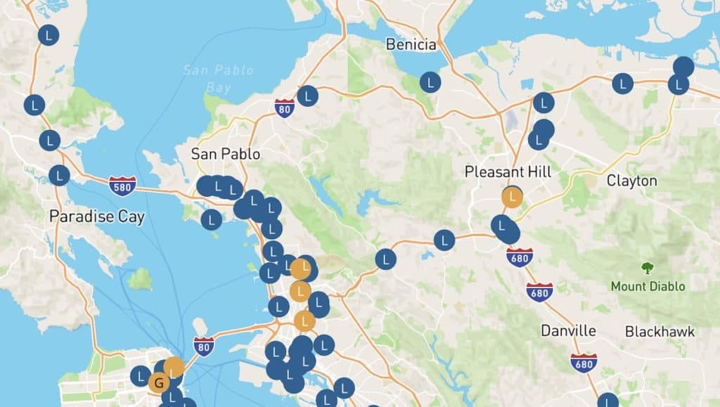
Keep your bike secure when you ride. We’ve compiled a map of Contra Costa bike locker locations, as well as information on bike stations throughout the greater Bay Area.
East Bay Regional Park District Bike Maps
The East Bay Regional Park District maintains paved bike paths in the East Bay. Below are links to a selection of useful trails for bicycle commuting in Contra Costa County.
- Big Break Regional Trail
- Contra Costa Canal Trail
- Delta de Anza Regional Trail
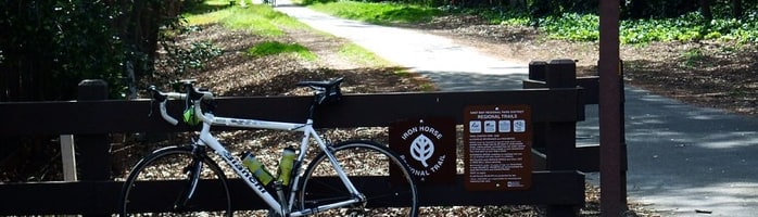
- Iron Horse Regional Trail
- Lafayette-Moraga Regional Trail
- Marsh Creek Trail
- McLaughlin Eastshore State Park
Other Regional and Bay Area Bike Maps
Local cities and other trail organizations offer resource sites or PDF downloads of bicycling routes in their area.
511 SF Bay: Bay Area Trail Maps, City Bike Maps & County Bike Maps
511 SF Bay’s extensive list of maps to help you find bike paths and trails in your area as well as bikeways and great places to ride in the larger Bay Area.
Transit to Trails Map
A downloadable PDF map showing transit connections to protected parks and open spaces all over the San Francisco Bay Area.
San Francisco Bay Trail Maps
These colorful trail maps are designed for walkers, skaters, bicyclists, wildlife watchers, and other trail enthusiasts and cover more than 230 miles of completed trail.
Richmond Bike Path and Bay Trail
A downloadable PDF map provided by the City of Richmond.
The cities of Richmond, Walnut Creek and Concord offer handy guides and maps for cycling around town.